Dominion Atlantic Railway Digital Preservation Initiative - Wiki
Use of this site is subject to our Terms & Conditions.
File:Kentville Fire Map 1921 Sheet 3.jpg
From DARwiki
Size of this preview: 800 × 336 pixels. Other resolutions: 320 × 134 pixels | 3,158 × 1,327 pixels.
Original file (3,158 × 1,327 pixels, file size: 1.42 MB, MIME type: image/jpeg)
Summary
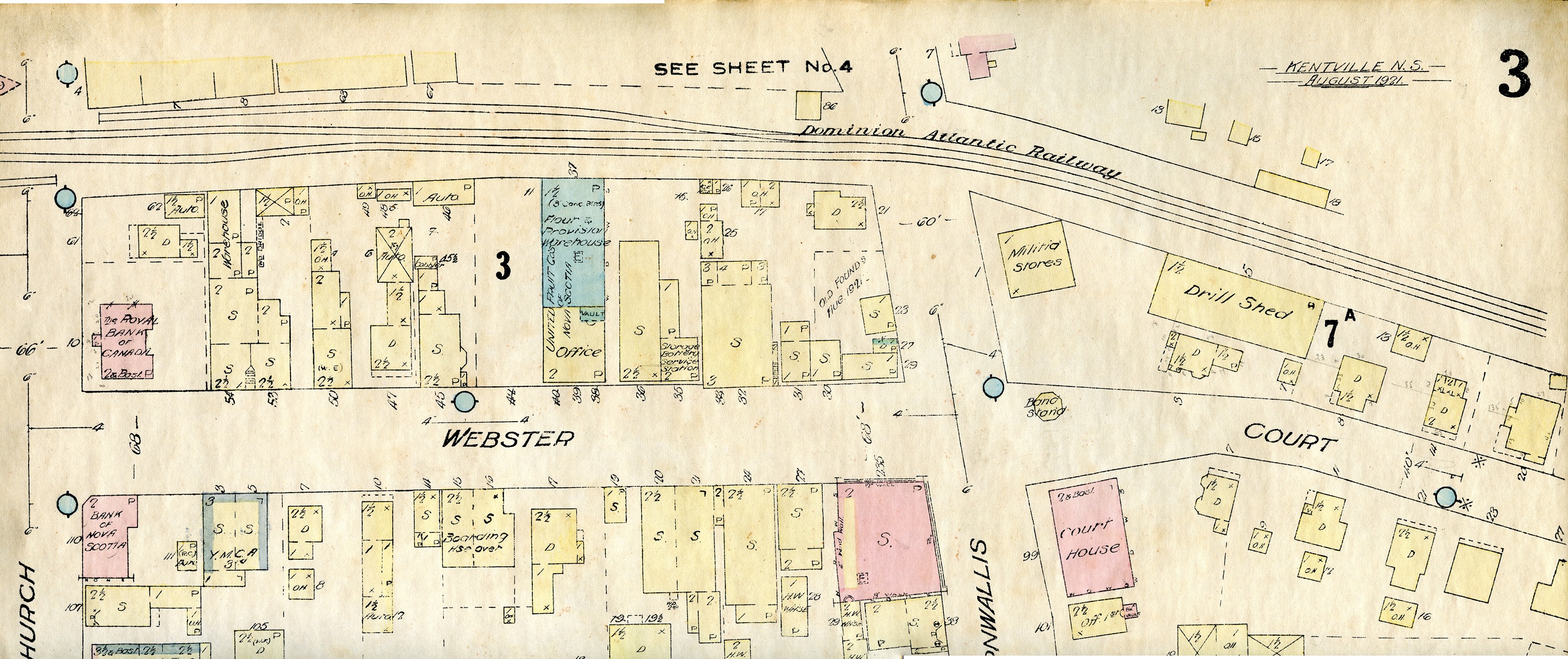
Detail of Kentville Fire Insurance Map showing, Sheet 3, with business along Webster Street including the United Fruit Companies Headquarters and the P. R. Ritcey Spur, August 1921, from the Comeau Family Collection.
Note: Fire insurance plans provide detailed information on structures, but only approximate information on track layout. See the railway's Track Charts for precise information on tracks.
File history
Click on a date/time to view the file as it appeared at that time.
| Date/Time | Thumbnail | Dimensions | User | Comment | |
|---|---|---|---|---|---|
| current | 18:54, 19 January 2022 | | 3,158 × 1,327 (1.42 MB) | Dan Conlin (talk | contribs) | Detail of Kentville Fire Insurance Map showing, Sheet 3, with business along Webster Street including the United Fruit Companies Headquarters and the P. R. Ritcey Spur, August 1921, from the Comeau Family Collection. Category:Louis Comeau Category:Fire Insurance Maps |
You cannot overwrite this file.
File usage
The following 4 pages use this file: