Dominion Atlantic Railway Digital Preservation Initiative - Wiki
Use of this site is subject to our Terms & Conditions.
File:HA-38.60 Hantsport Track Chart.JPG
Original file (1,995 × 1,465 pixels, file size: 330 KB, MIME type: image/jpeg)
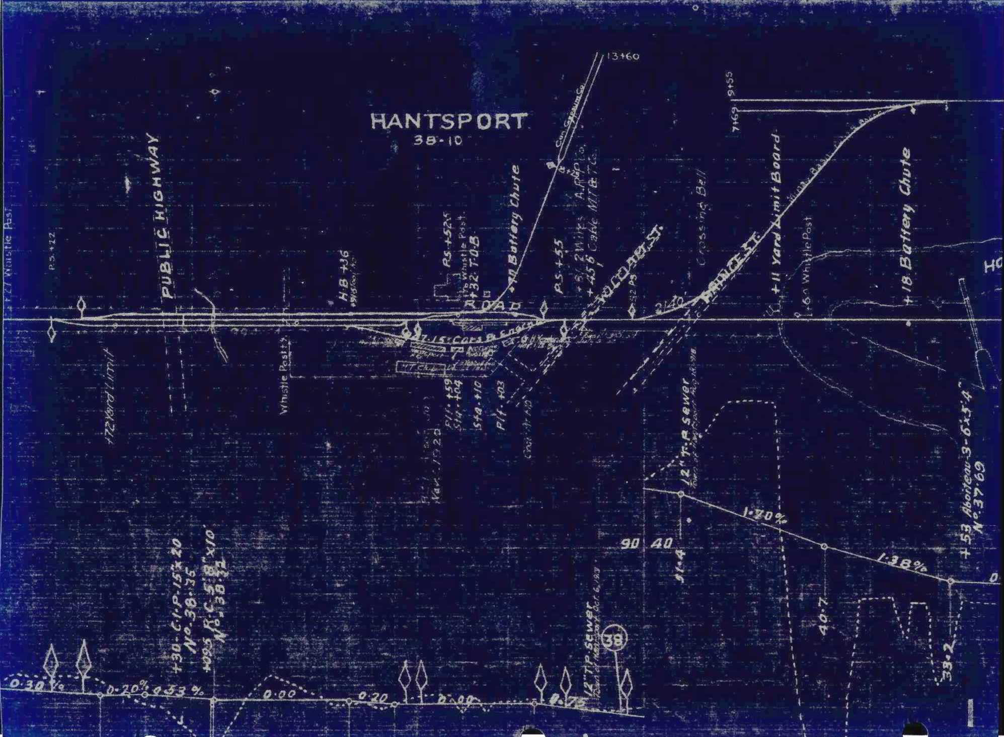
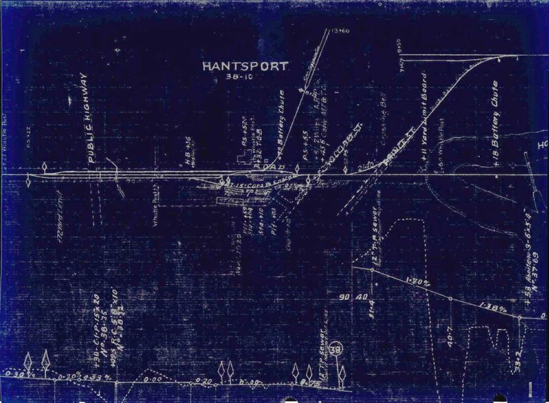
A clip of the March 18, 1918 C.P.R. track profile drawing showing Hantsport. The orientation of the track is west to the left (looking from the south). The track schematics were known to have been updated until at least 1926 from notes made on other sections of this schematic. Details include the Canadian Gypsum Company loading spurs, the Minas Basin Pulp spurs, the Hantsport Railyard, and the town's three apple warehouses, in addition to the Halfway River Bridge and Aboiteau at the far right.
File history
Click on a date/time to view the file as it appeared at that time.
| Date/Time | Thumbnail | Dimensions | User | Comment | |
|---|---|---|---|---|---|
| current | 11:17, 24 February 2020 | | 1,995 × 1,465 (330 KB) | Stem (talk | contribs) | |
| 19:39, 3 January 2020 | 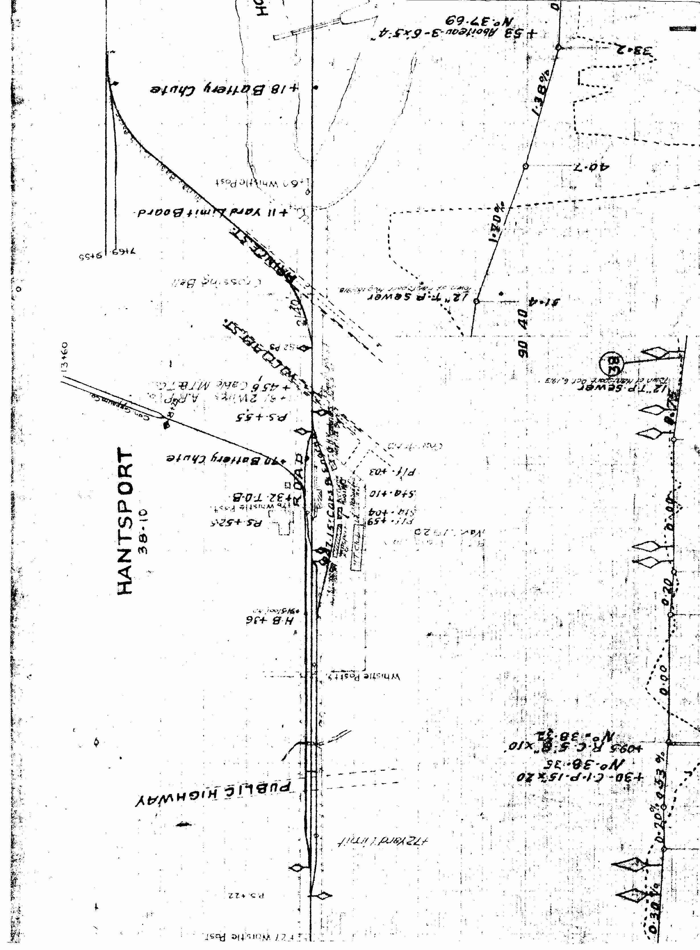 | 3,332 × 2,456 (1.01 MB) | Dan conlin (talk | contribs) | Track schematic for Hantsport. The plan is undated, but appears to be in the 1920s. Details include the Canadian Gypsum Company loading spurs, the Minas Basin Pulp spurs, apple warehouses and the [[Halfway River Bridge|Halfway River Bridge and Aboi... |
You cannot overwrite this file.
File usage
The following 4 pages use this file: