Dominion Atlantic Railway Digital Preservation Initiative - Wiki
Use of this site is subject to our Terms & Conditions.
File:DARSMaitlanDunnsCornersWest.jpg
From DARwiki
Size of this preview: 800 × 460 pixels. Other resolutions: 320 × 184 pixels | 3,493 × 2,010 pixels.
Original file (3,493 × 2,010 pixels, file size: 814 KB, MIME type: image/jpeg)
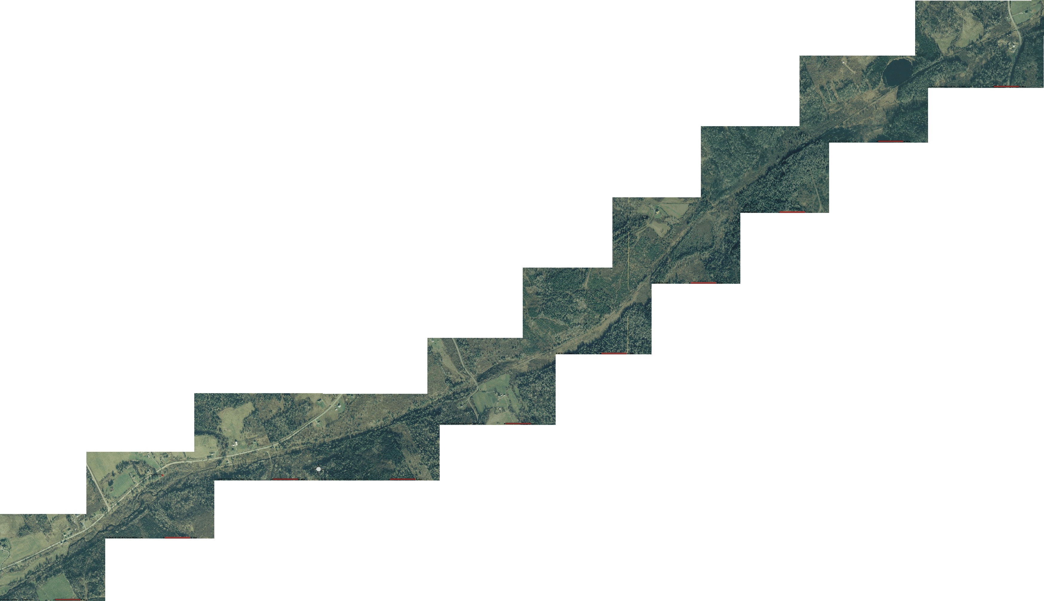
Map 04a South Maitland to Dunn's Corners, West
After hurricane Juan the government of Nova Scotia commissioned an aerial survey to find the extent of damage to forests. Part of the survey covered the former DAR right of way and I've stitch the what was available into four maps that cover Truro to Dunn's Corners where the survey ended.
File history
Click on a date/time to view the file as it appeared at that time.
| Date/Time | Thumbnail | Dimensions | User | Comment | |
|---|---|---|---|---|---|
| current | 08:48, 3 April 2011 | | 3,493 × 2,010 (814 KB) | Stem (talk | contribs) |
You cannot overwrite this file.
File usage
The following page uses this file: