Dominion Atlantic Railway Digital Preservation Initiative - Wiki
Use of this site is subject to our Terms & Conditions.
Difference between revisions of "File:Newport-MtUniacke1909.jpg"
Dan conlin (talk | contribs) (Detail of the Dominion Atlantic from Newport to Mount Uniacke taken from the federal government map "Province of Nova Scotia, Hants County, Windsor Sheet No 73"; Faribault, E R; Fletcher, H. Geological Survey of Canada, Multicoloured Geological...) |
Dan conlin (talk | contribs) m |
||
| Line 1: | Line 1: | ||
| − | Detail of the Dominion Atlantic from [[Newport]] to [[Mount Uniacke]] taken from the federal government map "Province of Nova Scotia, Hants County, Windsor Sheet No 73"; Faribault, E R; Fletcher, H. Geological Survey of Canada, Multicoloured Geological Map 1037, 1909, a geological map of the Windsor area in 1909. Locations shown include [[Hartville]], Dawson Siding, [[Stillwater]], [[Stillwater Lake]] (near Beeswanger Lake) and [[Claremont's]] (above the 63 55 longitude marker). | + | Detail of the Dominion Atlantic from [[Newport]] to [[Mount Uniacke]] taken from the federal government map "Province of Nova Scotia, Hants County, Windsor Sheet No 73"; Faribault, E R; Fletcher, H. Geological Survey of Canada, Multicoloured Geological Map 1037, 1909, a geological map of the Windsor area in 1909. Locations shown include [[Hartville]], [[Ellershouse]], Dawson Siding, [[Stillwater]], [[Stillwater Lake]] (near Beeswanger Lake) and [[Claremont's]] (above the 63 55 longitude marker). |
Source of original: | Source of original: | ||
http://geoscan.nrcan.gc.ca/starweb/geoscan/servlet.starweb?path=geoscan/downloade.web&search1=R=107895 | http://geoscan.nrcan.gc.ca/starweb/geoscan/servlet.starweb?path=geoscan/downloade.web&search1=R=107895 | ||
Revision as of 20:03, 12 March 2020
Detail of the Dominion Atlantic from Newport to Mount Uniacke taken from the federal government map "Province of Nova Scotia, Hants County, Windsor Sheet No 73"; Faribault, E R; Fletcher, H. Geological Survey of Canada, Multicoloured Geological Map 1037, 1909, a geological map of the Windsor area in 1909. Locations shown include Hartville, Ellershouse, Dawson Siding, Stillwater, Stillwater Lake (near Beeswanger Lake) and Claremont's (above the 63 55 longitude marker).
Source of original: http://geoscan.nrcan.gc.ca/starweb/geoscan/servlet.starweb?path=geoscan/downloade.web&search1=R=107895
File history
Click on a date/time to view the file as it appeared at that time.
| Date/Time | Thumbnail | Dimensions | User | Comment | |
|---|---|---|---|---|---|
| current | 19:25, 12 March 2020 | 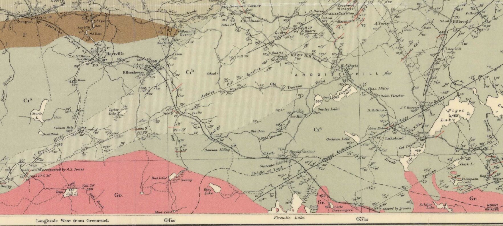 | 1,765 × 795 (503 KB) | Dan conlin (talk | contribs) | Detail of the Dominion Atlantic from Newport to Mount Uniacke taken from the federal government map "Province of Nova Scotia, Hants County, Windsor Sheet No 73"; Faribault, E R; Fletcher, H. Geological Survey of Canada, Multicoloured Geological... |
You cannot overwrite this file.
File usage
The following 4 pages use this file: