Dominion Atlantic Railway Digital Preservation Initiative - Wiki
Use of this site is subject to our Terms & Conditions.
Difference between revisions of "Auburn"
From DARwiki
Dan conlin (talk | contribs) (image) |
|||
| Line 18: | Line 18: | ||
<Gallery perrow=5> | <Gallery perrow=5> | ||
File:Berwick_21_H2_West.jpg|Topographic map from Auburn to Aylesford circa 1956. | File:Berwick_21_H2_West.jpg|Topographic map from Auburn to Aylesford circa 1956. | ||
| + | File:DAR-Auburn Station Sign Only-Harold Jenkins Photo-1July1961.JPG|[[Auburn]] station sign, July 1, 1961. | ||
</Gallery> | </Gallery> | ||
Revision as of 17:47, 4 October 2018
Auburn, Nova Scotia
Subdivision Kentville, Mile 19.1
Facilities & Features
Commerce & Industry
Description & History
Operations & Orders
Gallery
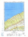
Topographic map from Auburn to Aylesford circa 1956.
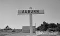
Auburn station sign, July 1, 1961.


References & Footnotes
- Alexander MacNab, Windsor and Annapolis Railway, Report of Alexander MacNab Nov 1, 1873
- 1969 Memorandum of General Information