Dominion Atlantic Railway Digital Preservation Initiative - Wiki
Use of this site is subject to our Terms & Conditions.
Difference between revisions of "File:Aylesford Looking East 1975 a.jpg"
From DARwiki
Dan conlin (talk | contribs) (water tank) |
|||
| (6 intermediate revisions by 2 users not shown) | |||
| Line 1: | Line 1: | ||
| − | Original Caption:Original Kodachrome Slide, | + | Original Caption:Original Kodachrome Slide, July 18, 1975, Dominion Atlantic track scene between Middleton and Kentville, NS. |
| − | + | [[Aylesford]] looking eastward. The foundation of the [[Aylesford Water Tower]] is visible in the weeds to the left of apple warehouse. | |
*[http://maps.google.com/maps/ms?ie=UTF8&hl=en&msa=0&t=h&msid=103391553118740314259.00045c182599e877ffcca&ll=45.027678,-64.842424&spn=0.027905,0.065918&z=15 Google Map Location] | *[http://maps.google.com/maps/ms?ie=UTF8&hl=en&msa=0&t=h&msid=103391553118740314259.00045c182599e877ffcca&ll=45.027678,-64.842424&spn=0.027905,0.065918&z=15 Google Map Location] | ||
| Line 7: | Line 7: | ||
*[[:Category:John A. MacIntosh Photo|John A. MacIntosh photo]] | *[[:Category:John A. MacIntosh Photo|John A. MacIntosh photo]] | ||
[[Category:John A. MacIntosh Photo]] | [[Category:John A. MacIntosh Photo]] | ||
| − | [[Category:John A. MacIntosh Photo 1975]] | + | [[Category:John A. MacIntosh Photo 1975|19750718-350]] |
Latest revision as of 21:08, 9 March 2010
Original Caption:Original Kodachrome Slide, July 18, 1975, Dominion Atlantic track scene between Middleton and Kentville, NS.
Aylesford looking eastward. The foundation of the Aylesford Water Tower is visible in the weeds to the left of apple warehouse.
File history
Click on a date/time to view the file as it appeared at that time.
| Date/Time | Thumbnail | Dimensions | User | Comment | |
|---|---|---|---|---|---|
| current | 12:40, 20 November 2008 | 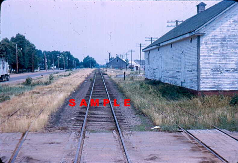 | 790 × 543 (127 KB) | Stem (talk | contribs) |
You cannot overwrite this file.
File usage
The following 2 pages use this file: