Dominion Atlantic Railway Digital Preservation Initiative - Wiki
Use of this site is subject to our Terms & Conditions.
Difference between revisions of "File:Waterville looking east 1975 a.jpg"
From DARwiki
| (5 intermediate revisions by the same user not shown) | |||
| Line 1: | Line 1: | ||
| + | Original Caption:Original Kodachrome Slide, 7/18/75, Dominion Atlantic track scene between Middleton and Kentville, NS. | ||
| + | This is a photo of Waterville looking eastward. | ||
| + | |||
| + | *[http://maps.google.com/maps/ms?ie=UTF8&hl=en&msa=0&t=h&msid=103391553118740314259.00045c182599e877ffcca&ll=45.027678,-64.842424&spn=0.027905,0.065918&z=15 Google Map Location] | ||
| + | |||
| + | *[[:Category:John A. MacIntosh Photo|John A. MacIntosh photo]] | ||
| + | [[Category:John A. MacIntosh Photo]] | ||
| + | [[Category:John A. MacIntosh Photo 1975|19750718-450]] | ||
Latest revision as of 22:59, 20 May 2009
Original Caption:Original Kodachrome Slide, 7/18/75, Dominion Atlantic track scene between Middleton and Kentville, NS.
This is a photo of Waterville looking eastward.
File history
Click on a date/time to view the file as it appeared at that time.
| Date/Time | Thumbnail | Dimensions | User | Comment | |
|---|---|---|---|---|---|
| current | 13:11, 20 November 2008 | 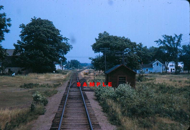 | 790 × 542 (123 KB) | Stem (talk | contribs) |
You cannot overwrite this file.
File usage
There are no pages that use this file.